 Raul Delapena Setiawan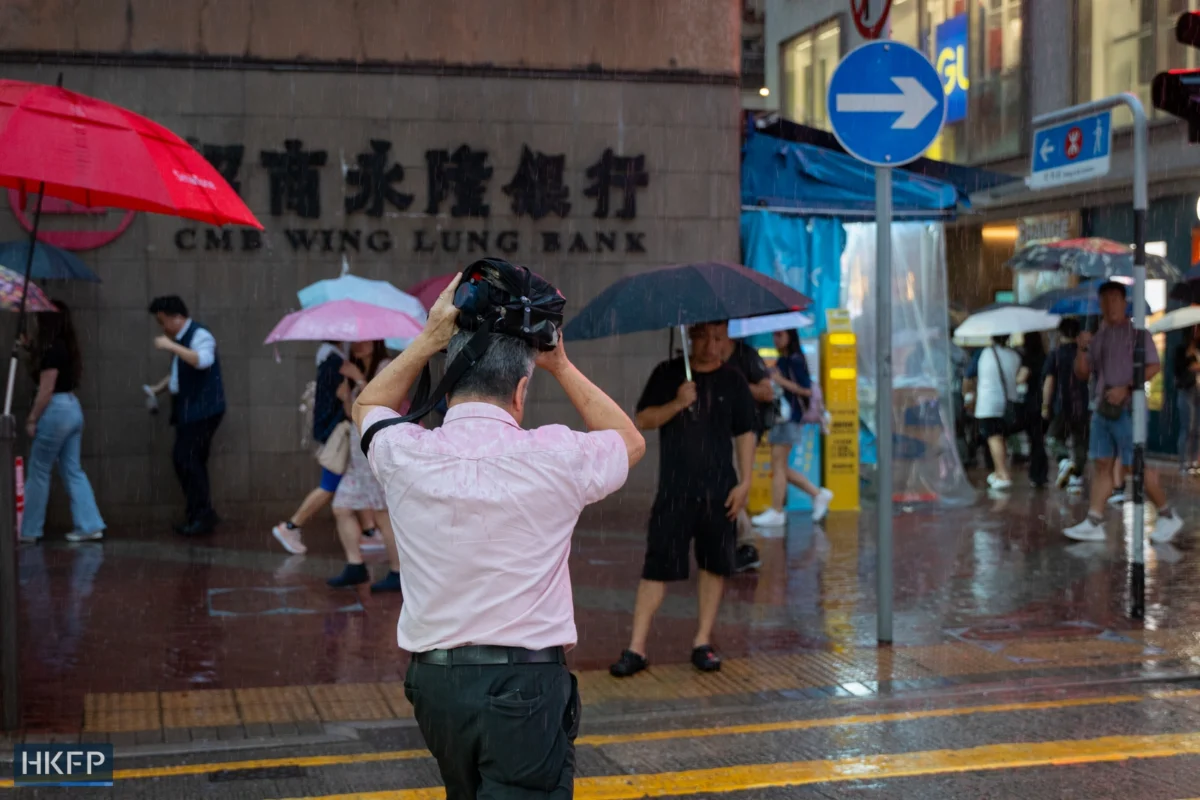
Hong Kong experienced an exceptionally wet July, marking it as the second-rainiest month on record since observations began in 1884. The Hong Kong Observatory (HKO) reported a staggering total of 790.3 millimeters of rainfall, more than double the historical average for the month, which stands at 385.8 mm. This deluge was punctuated by the issuance of 20 amber rainstorm warnings and five red rainstorm warnings, underscoring the severity of the meteorological conditions.
The city’s relentless rainfall was a persistent feature throughout July, with precipitation recorded on all but four days: the 11th, 12th, 22nd, and 24th. This sustained period of wet weather significantly impacted daily life and infrastructure across Hong Kong. The HKO’s detailed meteorological records indicate that only July of 1994 surpassed the recent month in terms of rainfall, with a colossal 1,147.2 mm recorded.
Understanding the Meteorological Drivers

The HKO attributed the extreme rainfall to a confluence of significant weather systems. A broad trough of low pressure spanned the region, coupled with an active southerly airstream that facilitated the transport of moisture inland. Furthermore, rainfall associated with tropical cyclones Maysak and Noul contributed substantially to the overall accumulation. These factors combined to create a consistently darker and wetter atmospheric environment for Hong Kong throughout July.
A Chronology of Intense Rainfall
The month began with persistent, moderate rainfall, leading to the issuance of the first amber rainstorm warnings. As July progressed, the intensity of the downpours escalated. By mid-month, specific regions within Hong Kong experienced localized flooding and disruptions, prompting the HKO to elevate warnings to the red level, indicating that heavy rain was expected to continue and could cause serious disruption.
The period between July 15th and July 20th, for instance, saw a significant surge in rainfall, with some districts reporting cumulative totals that contributed heavily to the monthly figure. The issuance of multiple red rainstorm warnings during this timeframe suggests that rainfall rates in certain areas exceeded 50 millimeters per hour, a threshold that signifies a high risk of flash floods and landslides. While no black rainstorm warnings, the highest level of alert indicating torrential rain, were issued, the sheer volume of rain and the frequency of amber and red warnings highlight the challenging weather Hong Kong faced.

In comparison to the previous year, July 2025 saw a total rainfall of 601.7 mm, accompanied by 14 amber rainstorm warnings, seven red rainstorm warnings, and one black rainstorm warning. While the number of red warnings was higher in 2025, the overall rainfall accumulation in the recent July demonstrates a more sustained and widespread deluge.
Broader Climate Context: The Influence of El Niño
The exceptionally wet July in Hong Kong is occurring within a broader context of significant climate shifts. The HKO had previously issued warnings about the potential for record-breaking high temperatures in Hong Kong in the coming years, attributing this forecast to the combined effects of climate change and the development of a “super-strong” El Niño event.
In June, HKO scientific officers Tse Kwan-shu and Tse Wai-po explained in a blog post that forecasts from multiple climate models indicated a continued rise in sea surface temperatures in the central and eastern equatorial Pacific. This warming trend was predicted to develop into an El Niño event by the summer and persist until at least the beginning of the following year.

El Niño is a natural climate phenomenon characterized by the abnormal warming of sea surface temperatures in the central and eastern equatorial Pacific Ocean. Its influence extends far beyond the Pacific basin, impacting weather patterns globally. During an El Niño event, many regions around the world typically experience abnormally high temperatures. Furthermore, El Niño can lead to an increase in the intensity of typhoons and can significantly alter seasonal rainfall patterns, resulting in either drought conditions or excessive rainfall in different parts of the globe.
While this specific July’s rainfall might seem counterintuitive to a phenomenon often associated with warmer and drier conditions in some parts of Asia, the complex interplay of global weather systems means that El Niño’s effects are not uniform. The presence of a strong trough of low pressure and active airstreams, as observed in Hong Kong’s July weather, can still draw in significant moisture, leading to intense rainfall events even during El Niño years.
Implications and Potential Impacts
The persistent heavy rainfall in July has several potential implications for Hong Kong. Beyond the immediate disruption to daily life, including transportation delays and potential damage to infrastructure, prolonged periods of heavy rain can have longer-term consequences.

Infrastructure Strain: Hong Kong’s well-developed drainage systems are designed to cope with significant rainfall. However, the sheer volume and intensity of the rain experienced in July can test the capacity of these systems, potentially leading to localized flooding in low-lying areas and underpasses. This can disrupt essential services and create hazardous conditions for pedestrians and motorists.
Geological Stability: Steep terrain characterizes much of Hong Kong’s landscape. Prolonged saturation of the soil can increase the risk of landslides, particularly in areas with exposed slopes and informal structures. The HKO’s rainstorm warnings are often issued in conjunction with advisories regarding landslide risks. Emergency services are typically placed on high alert during such periods.
Water Resources: While excessive rainfall can lead to immediate challenges, it also contributes to replenishing Hong Kong’s reservoirs. Given the city’s reliance on imported water, any natural increase in local water resources is generally a positive development for long-term water security, provided that the infrastructure can effectively capture and store the precipitation.
Economic and Social Disruption: Severe weather events invariably impact economic activity. Businesses may face closures or reduced operating hours, supply chains can be disrupted, and the tourism sector can experience cancellations. The social impact includes increased risk for vulnerable populations, such as the elderly and those living in flood-prone areas, who may require assistance or evacuation.

Scientific Analysis and Future Outlook
The HKO’s continuous monitoring and data analysis are crucial for understanding these extreme weather events. The correlation between the intense July rainfall and the ongoing El Niño phenomenon, alongside broader climate change trends, suggests that Hong Kong may need to brace for more frequent and intense weather anomalies in the future.
The "super-strong" El Niño predicted by climate models is a significant factor. Such events have historically been associated with more pronounced global weather disruptions. For Hong Kong, this could translate to a wider range of potential outcomes, from more intense heatwaves to altered typhoon seasons and, as evidenced by the recent July, periods of exceptionally heavy rainfall.
The HKO’s proactive communication of these forecasts and warnings plays a vital role in public preparedness. By providing timely and accurate information, the observatory enables government agencies, businesses, and the public to take necessary precautions, thereby mitigating the potential impacts of severe weather. The ongoing research into the nuances of El Niño’s influence on regional weather patterns, particularly in the context of a warming planet, remains a critical area of scientific focus.

As Hong Kong navigates an era of increasing climate variability, understanding the interplay of global phenomena like El Niño with local meteorological conditions is paramount. The record-breaking rainfall of July serves as a stark reminder of the dynamic and often unpredictable nature of our climate and the importance of robust preparedness and adaptation strategies. The data from this past July will undoubtedly inform future climate projections and disaster preparedness plans for the region.


 Evan Lee Salim
 Nana
Nana